Beta Pilot Programme Now Open

Predictive Agronomic Intelligence for the Modern Enterprise

VersaAgro fuses patented satellite telemetry, in-field IoT sensors, and advanced AI to deliver precise crop health insights, protect yields, and maximize carbon-credit revenue across global agricultural operations.

Yield accuracy within 1.5%
10+ years R&D
Multi-constellation satellite
Patented AI platform
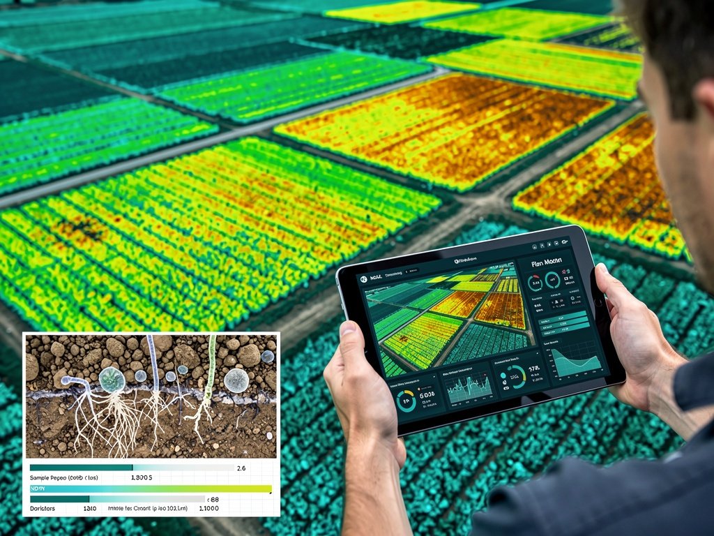
Field Telemetry Dashboard Live Sync Active
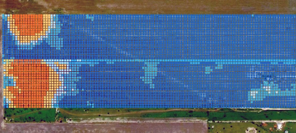
NDVI false-colour field analysis — orange stress zones bleeding into blue healthy canopy, 10m resolution grid overlay
Yield Confidence Index
98.9%
↑ +2.1% from baseline
Water Balance Model
Optimal
Field capacity at 84%
Carbon Sequestration
2,140 tCO₂e
Verifiable offset potential
Crop Stress Flag
None Detected
Sentinel-2 analysis clear
Maximized ESG & Carbon ROI
Multi-Constellation Satellite Data
North America & EMEA Aligned
Enterprise API & Reporting Integration
Patented Innovation Platform
Platform Capabilities

Patented Innovation for Modern Agronomy

VersaAgro UK — Platform Overview Callum’s Farmer Journey  ·  British East Midlands
Platform Overview Complete

VersaAgro transforms raw field data into strategic foresight. Our platform bridges the gap between field-level realities and boardroom sustainability mandates.

Digital Twin Intelligence

Create high-resolution digital replicas of your fields. Simulate physiological development, growing degree days (GDD), and crop lifecycles regardless of weather volatility.

View Dashboard

Satellite & Sensor Fusion

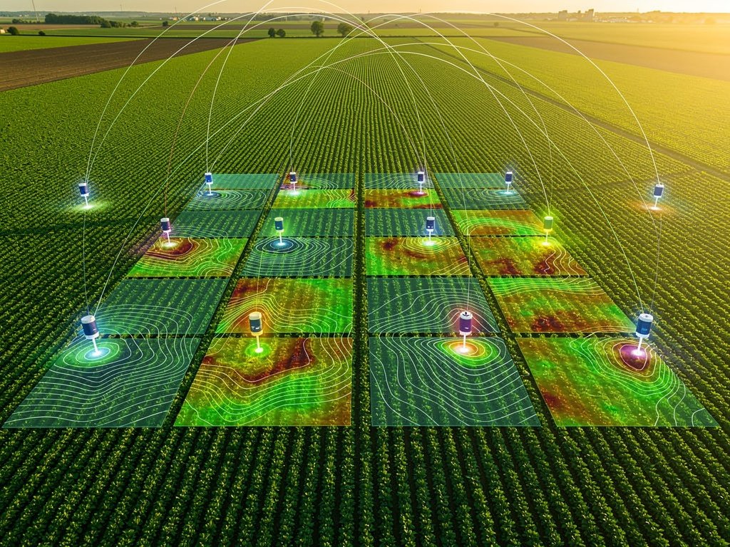
Ingest continuous Sentinel-2 satellite imagery combined with hyper-local IoT ground sensor telemetry to eliminate blind spots in crop monitoring down to 10m×10m cells.

Explore NDVI Analysis

Precision Water Balance

Monitor your soil's daily water bank statement. Detect stress flags before the wilting point is reached — optimize irrigation scheduling and protect yield potential.

See Water Metrics

Pest & Disease Risk Engine

AI-driven pest pressure forecasting correlates weather patterns, humidity, temperature thresholds, and crop phenology to deliver early-warning risk scores by field zone.

View Risk Alerts

Carbon & ESG Reporting

Automated sequestration tracking for verifiable carbon credit monetization. Align with EU Taxonomy, CSRD, and GHG Protocol while maximizing offset revenue per acre.

ESG Dashboard

Semantic Query & AEO

Ask natural-language questions of your field data. VersaAgro's knowledge graph maps triples and semantic relationships to surface actionable intelligence on demand.

Try Smart Query
Precision Insight Engine

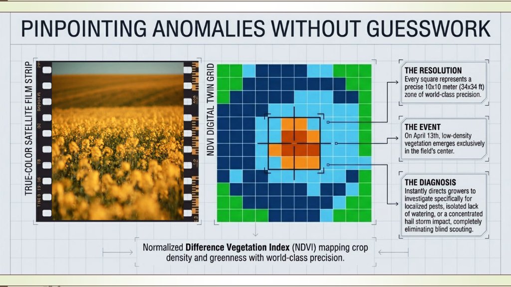
Pinpointing Anomalies — Down to Every 10m × 10m Without Guesswork

Each pixel represents a precise 10m × 10m (34×34 ft) ground-truth cell — the finest resolution in operational crop intelligence. Not a data point. A diagnosis. VersaAgro identified an irrigation rupture in a Nebraska soybean field weeks before visual symptoms, saving an estimated $48,000 in crop loss.

NDVI Digital Twin Grid — Colour Key
Red / Orange — Stress zone · immediate intervention
Cyan / Teal — Moderate health · monitoring advised
Deep Blue — Dense healthy canopy · optimal
Green boundary — Field margin / hedgerow
Farmers Carbon Markets Crop Insurance Investors Universities Yield Profitability
Independently Validated · Game-Changing Accuracy

±1.5% optimal crop yield prediction — proven across field trials by agronomists & universities. A bankable number for farmers, insurers, carbon markets & investors alike.

NDVI Digital Twin Grid: true-colour satellite film strip alongside false-colour NDVI grid — orange stress cluster pinpointed inside healthy blue-green canopy, with resolution, event and diagnosis callouts
NDVI mapping crop density & health at 10m × 10m precision — from true-colour satellite to digital twin grid diagnosis.
±1.5%
Yield prediction accuracy
Agronomist & university validated
10m²
Minimum detection cell
Industry-leading ground resolution
5-day
Satellite revisit cadence
Sentinel-2 twin constellation
120+
Crop types supported
Cereals, legumes, specialty, carbon
Global Coverage

From Hay to Hydroponics. Every Crop. Every Continent.

VersaAgro monitors 120+ crop types from satellite telemetry and edge IoT sensors across North America, EMEA, and Latin America.

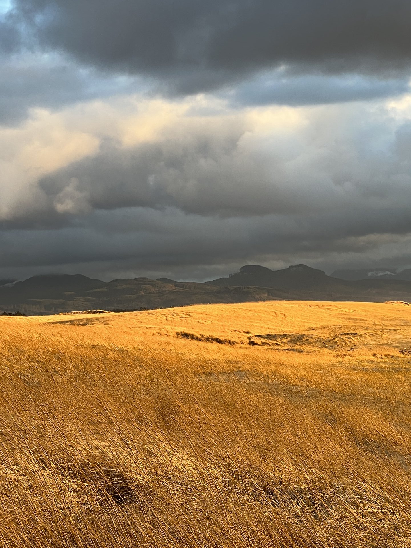
Hay bales in mountain pasture — Bolivia Altiplano
Hay / Alfalfa
Las Anguillas, Bolivia
NDVI ActiveWater Watch
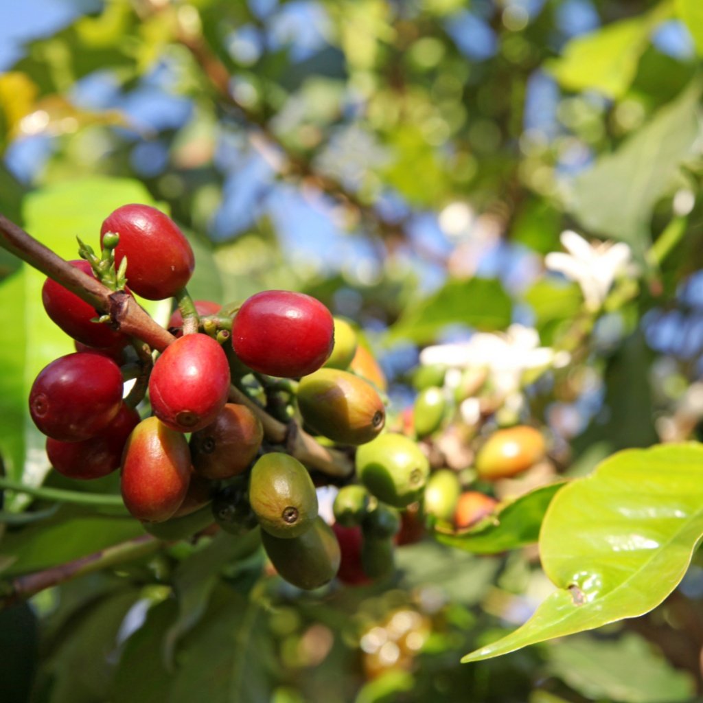
Ripe and ripening coffee cherries on branch — Tanzania Highlands
Coffee
Rauya, Tanzania
OptimalCarbon+
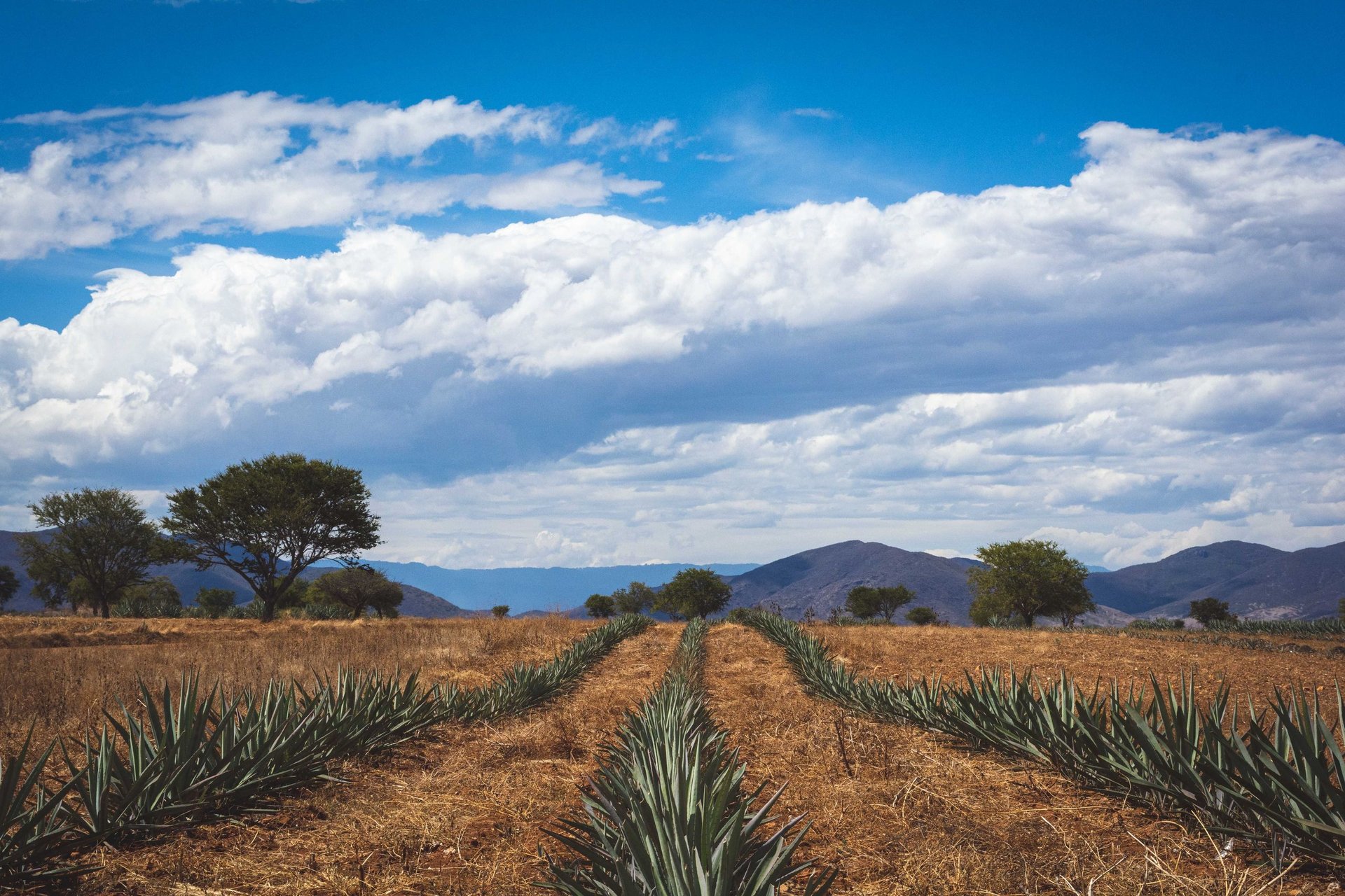
Blue agave plants under sky — Jalisco Mexico
Blue Agave
Jalisco, MX
Sentinel-2Drought Risk
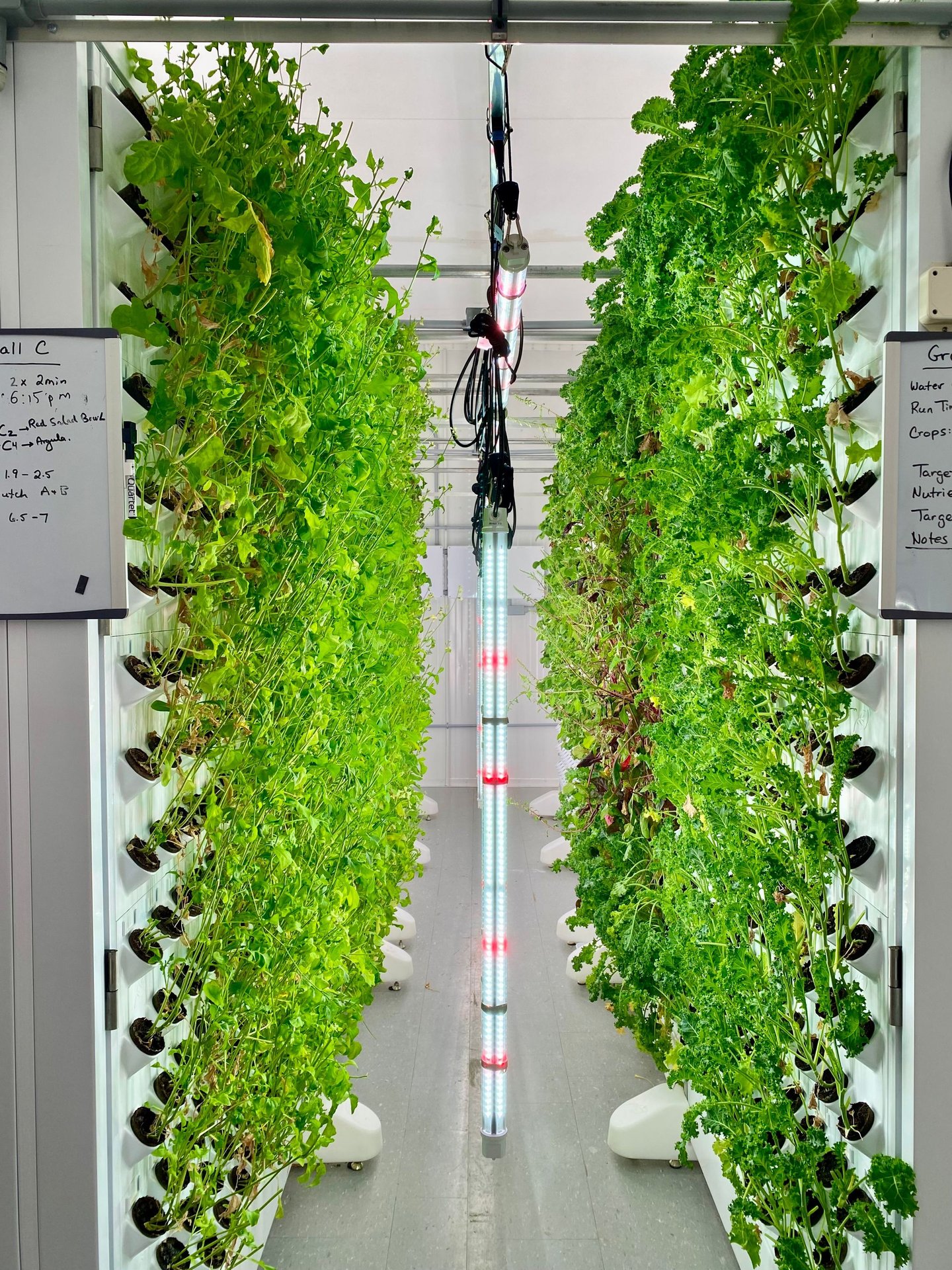
Vertical hydroponic farm with LED lighting — controlled environment
Hydroponics
Controlled Environment
IoT DenseDigital Twin
Prototype Screens

Every Decision Surface, Covered

A complete platform from field telemetry to boardroom ESG reporting. Click any screen to explore the live prototype.

Semantic Intelligence

A Knowledge Graph for Agricultural Science

VersaAgro maps semantic relationships between crops, pathogens, weather events, interventions, and financial outcomes — powering AEO-optimised navigation, smart search, and AI-assisted decision support.

Every entity in the platform is modelled as a triple-store node: Crop → Stress Type → Recommended Action. This enables contextual recommendations, glossary-powered search, and supply chain traceability.

NDVI → Crop Health Rainfall → Fungal Risk Temperature → Pest Pressure Soil Moisture → Irrigation GDD → Harvest Date Carbon → ESG Score Fertiliser → Yield ROI Sentinel-2 → Digital Twin
Crop Entity
Satellite
Weather
Pest Risk
Carbon
IoT Sensor
Action
Knowledge Base

Frequently Asked Questions

Answers for every stakeholder — from field operators to carbon auditors. Select your role below.

VersaAgro fuses Sentinel-2 satellite imagery at 10m × 10m resolution with your IoT ground sensor data to calculate real-time NDVI and LAI indices. Our Precision Insight Engine flags anomalies up to 14 days before visible symptoms appear — giving you time to act on irrigation deficits, nutrient stress, and early-stage pest pressure rather than react after damage has occurred.
No. VersaAgro works immediately with publicly available Sentinel-2 and Landsat satellite data — no on-farm hardware required. If you already have IoT soil sensors, weather stations, or drone equipment, VersaAgro can ingest those data streams to sharpen accuracy further. You can start with satellite-only telemetry and layer in edge devices progressively as your operation scales.
VersaAgro currently supports 120+ crop types — including cereals (wheat, corn, rice), legumes (soy, chickpea), specialty crops (coffee, cacao, grapes, agave), and carbon-eligible regenerative crops (cover crops, agroforestry systems). Geographic coverage spans North America, Latin America (including Cerrado and Andean highlands), Sub-Saharan Africa, and the EMEA region. New biomes are added with each quarterly platform release.
Our yield confidence model achieves ±1.5% mean absolute error against verified harvest weights across our pilot cohort — validated independently by three university agronomy departments. The model integrates NDVI time-series, Growing Degree Days (GDD), precipitation anomaly, soil moisture balance, and historical yield curves for each crop-region pair. Confidence intervals are displayed transparently in the Field Telemetry Dashboard so you can calibrate your marketing and logistics decisions accordingly.
Visit our Beta Access Request page and complete the 3-step onboarding form. We review applications within 5 business days and prioritise operations with diverse crop-region profiles. Pilot participants receive full platform access, dedicated agronomist onboarding support, and a data-sharing agreement that keeps your farm data sovereign and never shared with third parties without your explicit consent.
VersaAgro's Crop Intelligence module is designed to complement rather than replace field scouting. It surfaces satellite-derived NDVI anomaly zones as priority areas on an interactive map — so you deploy scouts where they are most needed. Scout observations can be logged directly in-platform, creating a closed feedback loop that trains the ML models on your specific crop-region-variety combinations over time.
Yes. The Alerts & Risk Management module supports variety-level threshold customisation across 14 stress vectors including NDVI decline rate, soil moisture deficit, GDD deviation, and cumulative heat stress. Thresholds can be staged by growth phase (germination, vegetative, reproductive, maturation), and you can set separate severity tiers (advisory, warning, critical) with corresponding notification channels — email, SMS, or in-platform push.
The Digital Twin overlays a 10m × 10m analysis grid onto your field boundaries, calculating a composite health score per cell based on NDVI, soil-adjusted vegetation index (SAVI), enhanced vegetation index (EVI), and any available sensor inputs. The overlay updates every 5 days on Sentinel-2 pass cycles. Zone scores are clustered into management zones using an unsupervised k-means algorithm, allowing variable-rate application planning down to sub-field prescriptions.
Export to ISO-XML, Shapefile, and GeoTIFF prescription formats is on the Q3 2025 roadmap for beta participants. During the current pilot phase, zone recommendations are visualised in-platform and can be exported as georeferenced PDFs for manual equipment setup. Full API integration with John Deere Operations Centre, CNH AFS, and Climate FieldView is planned for GA release.
VersaAgro's multi-tenant architecture allows operators and cooperatives to manage thousands of distinct field parcels under a single dashboard. The Field Telemetry Dashboard aggregates KPIs at entity, region, and portfolio levels with drill-down to individual field performance. Role-based access control allows you to assign grower-level, agronomist-level, and manager-level permissions without exposing sensitive commercial data across your network.
During the pilot phase, VersaAgro supports CSV/Excel bulk import for historical yield, input records, and field boundary files (GeoJSON/KML). REST API connectors for SAP Agriculture, AgLeader, and Trimble Ag Software are in active development. Our integration team can work with your IT department to map custom data schemas — particularly for cooperative members operating different FMS platforms within the same network.
VersaAgro is built on a Circular Sovereignty data model: each grower's field data is logically isolated in tenant-partitioned storage, encrypted at rest (AES-256) and in transit (TLS 1.3). Data is never aggregated for commercial resale, benchmarking products, or input company data partnerships without explicit opt-in consent. Growers retain full data portability rights — bulk export is available at any time in standard open formats. This aligns with GDPR Article 20 and the EU Data Act.
Cooperatives can aggregate carbon sequestration data across their member base to meet minimum project size thresholds required by voluntary carbon standards (Verra VCS, Gold Standard, ISO 14064). VersaAgro's Carbon & ESG module provides field-level measurement, reporting, and verification (MRV) data trails that satisfy third-party auditor requirements. Co-op administrators can manage consent, generate combined reports, and distribute carbon revenue back to individual growers through the platform's payment allocation tools.
VersaAgro operates a SaaS subscription model tiered by hectares under management — ranging from single-farm individual plans to enterprise cooperative licences. Secondary revenue streams include: (1) carbon credit facilitation fees on verified tonnes issued through our MRV pipeline; (2) premium analytics API access for agrochemical and input companies seeking anonymised market intelligence (consent-gated); and (3) professional services for implementation and data migration. Full commercial terms and unit economics are available under NDA to qualified investors.
The global precision agriculture market is projected to reach USD 24.1 billion by 2030 (CAGR 13.1%). VersaAgro differentiates on three vectors: (1) 10m resolution Digital Twin granularity — most SaaS competitors operate at 30m+ field averages; (2) integrated carbon MRV pipeline within the same platform rather than requiring separate registry integrations; and (3) a Knowledge Graph-powered semantic search layer that creates proprietary agronomic ontology data moats over time. Our Versalytix parent brings proven sensor analytics IP from adjacent industrial sectors.
VersaAgro's Carbon & ESG Intelligence module produces automated compliance reports aligned with CSRD (EU Corporate Sustainability Reporting Directive), GHG Protocol Scope 3 (Land Use and Agriculture), and TCFD agricultural sector guidance. Farm-level ESG scorecards track water use intensity, synthetic input reduction, biodiversity indices, and verified carbon sequestration — all of which can be rolled up to portfolio-level for institutional investor ESG reporting and impact fund disclosures.
Please visit the Leadership page to connect with our CFO and Board team directly, or reach out via the Early Access form selecting "Investor / Finance" as your role. Qualified institutional investors can request access to our secure data room, pilot programme performance reports, and full technical architecture documentation under a standard mutual NDA.
Every data event in VersaAgro is written to an append-only audit log with cryptographic timestamps, satellite overpass provenance references, and sensor calibration certificates. Auditors can access a read-only audit portal that surfaces: field boundary history, NDVI time-series with acquisition metadata, IoT sensor data lineage, carbon stock change calculations with methodology citations (IPCC Tier 1/2/3), and all manual data entry events with user and timestamp attribution.
VersaAgro's MRV pipeline is designed against Verra VCS VM0042 (Improved Agricultural Land Management), Gold Standard LandScale, and the emerging ISO 14064-2:2024 requirements for agricultural project quantification. The methodology module allows project developers to select the applicable standard; the platform then enforces the corresponding monitoring frequency, data quality requirements, and uncertainty discounting rules automatically. IPCC Tier 2 soil carbon models are implemented for temperate and tropical biomes.
All satellite imagery ingestion records include ESA Copernicus product identifiers, acquisition datetime (UTC), cloud cover percentage, and radiometric calibration version. Atmospheric correction is performed using Sen2Cor 2.11 with documented parameter sets archived per scene. If cloud cover exceeds the threshold defined in the project's monitoring plan, the platform flags that period as a data gap and applies the conservative estimation rules specified in the selected carbon methodology — ensuring no over-crediting risk during adverse weather windows.
Yes. Accredited third-party verifiers can request a read-only sandbox tenant populated with anonymised representative data. The sandbox supports full report generation, data lineage traversal, and methodology parameter inspection without affecting production project data. Access is granted via the Early Access form under the "Auditor / Verifier" role. Documentation for the audit API and data export schema is available on request.
VersaAgro employs a hybrid MRV approach combining satellite-derived above-ground biomass estimates (using SAR and multispectral fusion), soil organic carbon (SOC) modelling via the RothC and CENTURY models, and ground-truth soil sampling schedules calibrated to the project's baseline. The Digital Twin grid provides spatially explicit carbon stock change maps at 10m resolution — enabling far more precise additionality attribution than farm-average or county-average approaches used by legacy MRV providers.
Revenue depends on baseline land management, soil type, climate zone, and the applicable carbon standard. As a reference range: arable operations transitioning to no-till with cover cropping typically generate 0.5–2.0 tCO₂e/ha/yr; agroforestry integration can yield 3–8 tCO₂e/ha/yr. At current voluntary market prices (USD 15–50/tCO₂e for agricultural projects), this represents USD 7–400/ha/yr of additional income. VersaAgro's Carbon & ESG module provides a project-specific projection tool at onboarding so you can model your operation's potential before committing to a monitoring programme.
VersaAgro facilitates credit issuance through partner relationships with established carbon registries (Verra, Gold Standard) and connects project developers to pre-qualified corporate buyer pools through our marketplace partners. The platform handles the documentation workflow — from project design document (PDD) preparation to verification body submission and credit retirement tracking. Farm operators retain full ownership of their credits; VersaAgro charges a facilitation fee on successful issuance rather than purchasing credits speculatively.
VersaAgro follows a minimum-disclosure principle: only the data required by the chosen carbon methodology is shared with the registry and verifier — typically field boundaries, practice change evidence, and quantification model outputs. Detailed IoT sensor streams, yield records, and operational business data remain within your private data tenant. Buyers see only the registry-issued credit certificates, not the underlying farm data. This Circular Sovereignty approach ensures participation in carbon markets does not create surveillance or competitive exposure risks for your operation.
VersaAgro's MRV system implements continuous monitoring rather than periodic spot-checks — so reversals caused by tillage events, drought-induced dieback, or land-use change are detected rapidly via satellite NDVI and SAR anomaly signals. When a potential reversal is detected, the platform automatically triggers a verification workflow and calculates the buffer pool contribution required under the applicable standard's reversal risk assessment. Proactive monitoring reduces both the farmer's liability exposure and the systemic credibility risk that affects voluntary carbon market pricing.

Ready to See VersaAgro in Action?

Join our beta pilot programme and start generating agronomic intelligence and carbon revenue from your fields within weeks.

Request Beta Access Explore Platform Features